Image Credit: NOAA/NASA, GOES (Geostationary Environmental Operational Satellites), GOES-R, Image of the Day | Last Updated: Jan. 23, 2017
NASA Images of the Day | NOAA’s GOES-16 satellite sends first images of Earth
Since the GOES-16 satellite lifted off from Cape Canaveral on November 19, scientists, meteorologists and ordinary weather enthusiasts have anxiously waited for the first photos from NOAA’s newest weather satellite, GOES-16, formerly GOES-R.
The release of the first images today from NOAA’s newest satellite, GOES-16, is the latest step in a new age of weather satellites.It will be like high-definition from the heavens.

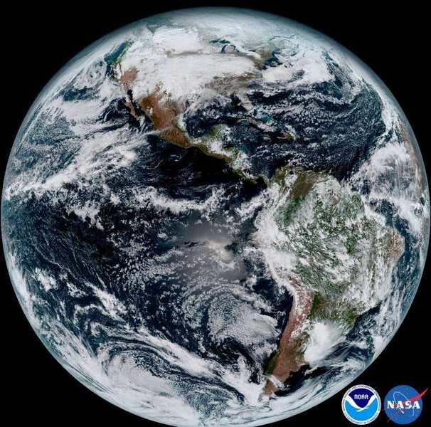
This composite color full-disk visible image is from 1:07 p.m. EDT on Jan. 15, 2017, and was created using several of the 16 spectral channels available on the GOES-16 Advanced Baseline Imager (ABI) instrument.
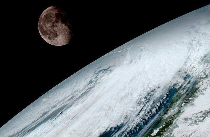
The image shows North and South America and the surrounding oceans. GOES-16 observes Earth from an equatorial view approximately 22,300 miles high, creating full disk images like these, extending from the coast of West Africa, to Guam, and everything in between.
GOES-16, formerly known as GOES-R, is the first spacecraft in a new series of NASA-built advanced geostationary weather satellites. NASA successfully launched the satellite at 6:42 p.m. EST on Nov. 19, 2016, from Cape Canaveral Air Force Station in Florida. NOAA manages the GOES-R Series Program through an integrated NOAA-NASA office. NASA’s Goddard Space Flight Center in Greenbelt, Maryland, oversees the acquisition of the GOES-R series spacecraft and instruments.
The pictures from its Advanced Baseline Imager (ABI) instrument, built by Harris Corporation, show a full-disc view of the Western Hemisphere in high detail — at four times the image resolution of existing GOES spacecraft. The higher resolution will allow forecasters to pinpoint the location of severe weather with greater accuracy. GOES-16 can provide a full image of Earth every 15 minutes and one of the continental U.S. every five minutes, and scans the Earth at five times the speed of NOAA’s current GOES imagers.

NOAA’s GOES-16, situated in geostationary orbit 22,300 miles above Earth, will boost the nation’s weather observation network and NOAA’s prediction capabilities, leading to more accurate and timely forecasts, watches and warnings.
“This is such an exciting day for NOAA! One of our GOES-16 scientists compared this to seeing a newborn baby’s first pictures — it’s that exciting for us,” said Stephen Volz Ph.D. director of NOAA’s Satellite and Information Service. “These images come from the most sophisticated technology ever flown in space to predict severe weather on Earth. The fantastically rich images provide us with our first glimpse of the impact GOES-16 will have on developing life-saving forecasts.”