Image Credit: NASA/JPL-Caltech | Last Updated: March 1, 2023
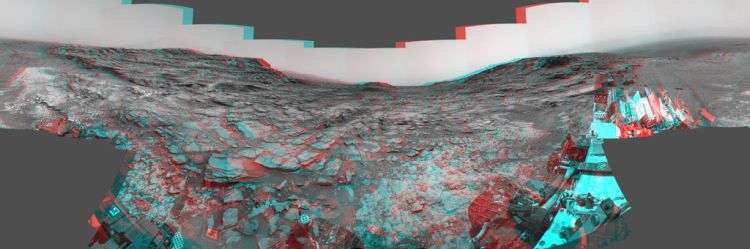
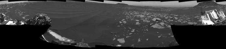
The left side of this 360-degree panorama from NASA’s Curiosity Mars rover shows the long rows of ripples on a linear shaped dune in the Bagnold Dune Field on the northwestern flank of Mount Sharp.
The view is a mosaic of images taken with Curiosity’s Navigation Camera (Navcam) on Feb. 5, 2017, during the 1,601st Martian day, or sol, of the rover’s work on Mars. The view is centered toward west-southwest, with east-southeast on either end.
The rover is a project of the Mars Science Laboratory (Curiosity).
A capped mound called “Ireson Hill” is on the right. A map showing Curiosity’s location on Sol 1601 is at http://mars.jpl.nasa.gov/multimedia/images/2017/curiosity-rovers-location-for-sol-1601. It also appears below, so please scroll down.
This map here shows the route driven by NASA’s Mars rover Curiosity through the 1601 Martian day, or sol, of the rover’s mission on Mars (dated February 06, 2023).
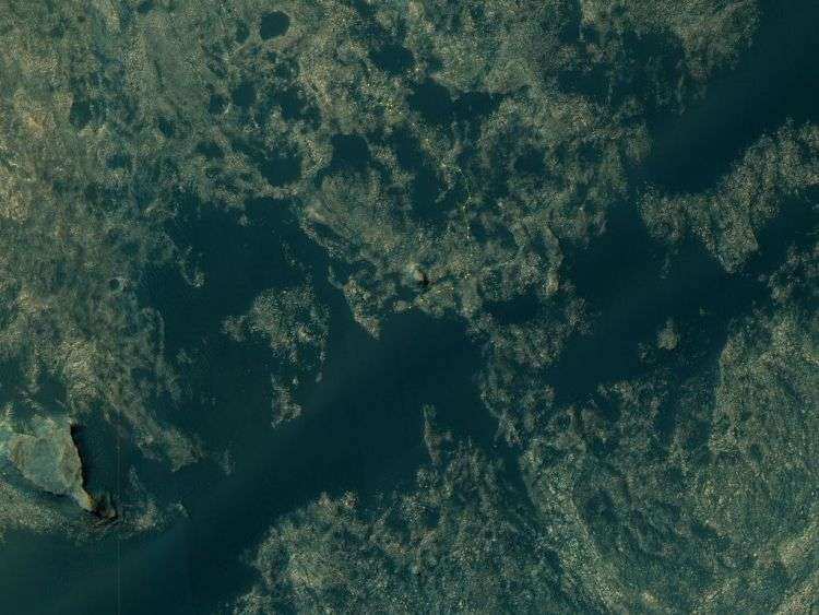
Numbering of the dots along the line indicate the sol number of each drive. North is up. From Sol 1598 to Sol 1601, Curiosity had driven a straight line distance of about 65.25 feet (19.89 meters). Since touching down in Bradbury Landing in August 2012, Curiosity has driven 9.60 miles (15.45 kilometers).
The base image from the map is from the High Resolution Imaging Science Experiment Camera (HiRISE) in NASA’s Mars Reconnaissance Orbiter.